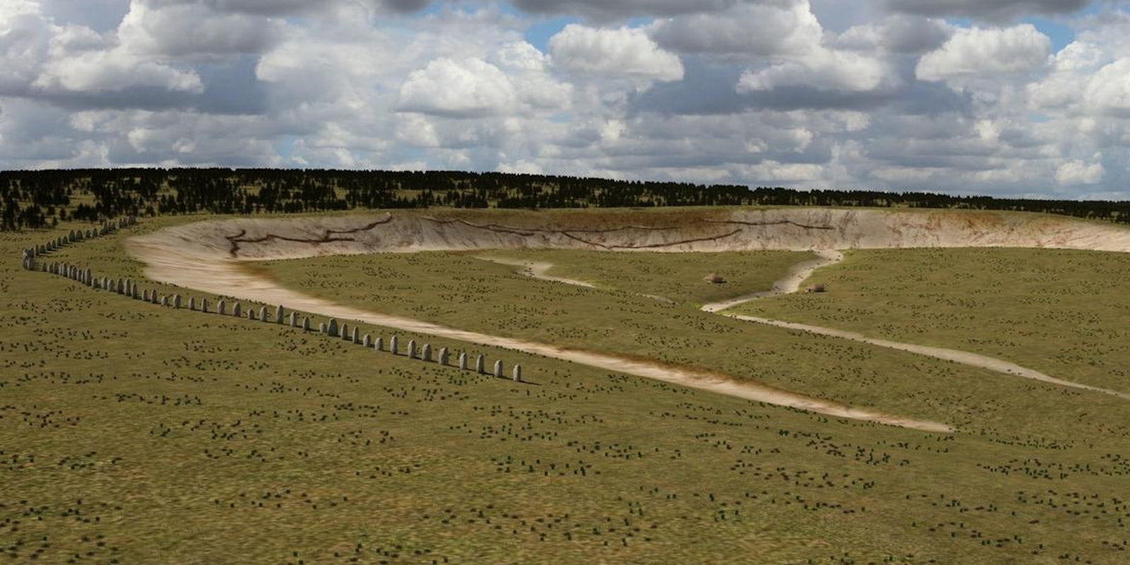
The Stonehenge Hidden Landscapes Project has unearthed a big brother to the famous standing stones. By unearth, we actually mean “looked beneath the earth with magic” and by magic we mean science.
The organization announced this week that, after undertaking five years of technical measuring, it discovered a much older, much, much bigger standing stone monument, located about two miles away at the Neolithic settlement of Durrington Wells. The new site is situated 1,000 years further in the past than Stonehenge, which was erected about 3,500 years ago.
This “Superhenge” was constructed around 4,500 years ago. 30 intact stones remain, each about 15 feet tall, with another 60 broken stones, fragments, and pits where stones once stood, arranged in a 320 foot long C-shaped ritual arena shape facing the Avon, of Stratford-on-Avon fame. If you’re wondering why something huger and older than Stonehenge has only just now been discovered, it’s because the whole thing is three feet underground.
The project employed a suite of technical methods, harmonizing “old” methods (meaning a few decades old) and brand new tools. They magnetometer measurements and ground penetrating radar surveys, aerial photography (both oblique- and ortho-photos), airborne laser scanning and hyperspectral scanning, understand the land surface, and what is buried beneath it.
The team plans to create “a highly detailed archaeological map of the ‘invisible’ landscape, providing the basis for a full interpretative synthesis of all existing remote sensing and geophysical data from the study area.”
Getting the data is one thing. Understanding it is another. The project has, and will continue, to churn out massive amounts of data. To understand it, SHLP is developing “new filtering tools for the removal of disturbing noise and for the generation of optimised final data images.” Additionally, topographical data in different scales have to be “merged and integrated into a GIS geo-database prior to archaeological interpretation” which will be expressed in part in a 3D environment.
The programming element of this project will enable “total digital models of the Stonehenge landscape at a true ‘landscape scale’ that will not only transcend the immediate surrounds of individual monuments within the study area, but will also tie them together within a seamless map of sub-surface and surface archaeological features and structures.”
The Superhenge, though the most dramatic discovery of the SHLP, is far from the only one. As per the name, the landscape around Stonehenge, or rather the landscapes, which remain hidden from us, are the target of the project. So far, the members have discovered 17 “previously unknown ritual monuments dating to the period when Stonehenge achieved its iconic shape.”
Mike Pitts, the editor of British Archaeology, published a detailed post examining the technology and interpretation. His findings, writ small, are: they are probably sarsen stones and they are probably related to Stonehenge and its era.
“There’s no denying they’ve found something,” Pitt wrote, “and any explanation that does not involve the long history of Stonehenge looks like special pleading. This is a genuine challenge to how we think about these sites, and potentially a major discovery and a stunning achievement for the research team.
But Pitts maintains that “without excavation…we will never get to the bottom of what it is they have found—what the pits are, what the solid things are, and how old they are.”
The excitement of digital archaeology is obvious, as are the benefits, like being able to get down to the features without damaging them. Still, there will be argument for some time about how effective the tech is without the aid of traditional tools, like trowels and twine.
H/T USA Today | Photo via LBI ArchPro/YouTube


