The bomb cyclone is making its way up the East Coast, and the photos making rounds on social media feeds are simultaneously terrifying and awe-inspiring.
Earther reports that pressure in the winter storm dropped 54 millibars in 24 hours. In non-science speak, that’s a lot of pressure—more than twice the amount needed to classify the cyclone as a “bomb.”
In practice, that makes for a storm with just as much impact as experts predicted. Cities as far north as Cape Cod are experiencing hurricane force winds, and lights are flickering in Massachusetts. There’s snow from Florida to Maine. Oh—and iguanacicles.
Unusual cold problem in South Florida: Iguanacicles. Iguanas cold-stunned, but probably not dead https://t.co/rpqzW1PpXX pic.twitter.com/0Lwxc7sYCe
— Kimberly Miller (@KMillerWeather) January 4, 2018
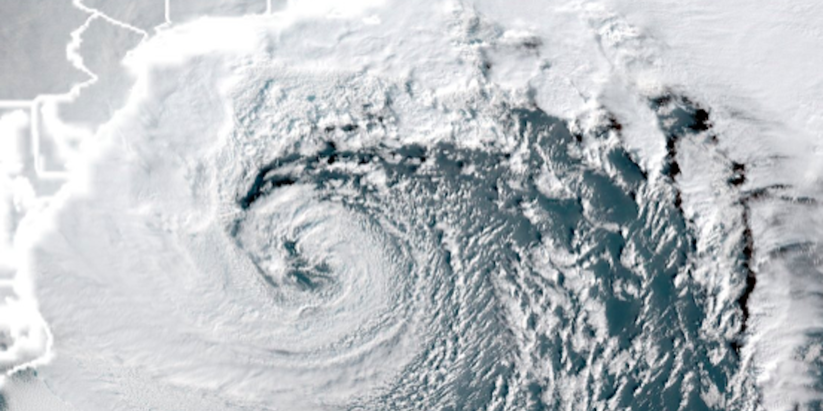
But the mesmerizing thing about the storm isn’t the piles of snow—it’s the way the bomb cyclone dances when you view it from space. Meteorologists, in particular, are swooning over images of the storm from the GOES-16 satellite.
I like the ‘true color’ option for #GOES16 becasue it looks like an old-timey image you’d see in a textbook or on @weatherchannel 25 years ago. #blizzard pic.twitter.com/GqLJCkzsaN
— Eric Fisher (@ericfisher) January 4, 2018
Here’s a closer look.
https://twitter.com/wx_becks/status/948925159020298240
Mesovortices near the center of the deepening east coast cyclone, as seen by @NOAA‘s #GOES16 1-minute visible imagery. #blizzard pic.twitter.com/p4p7bMIWwm
— NASA SPoRT (@NASA_SPoRT) January 4, 2018
Across the target areas, people are hunkering down and bracing for whatever the storm may bring. But for weather fanatics, the bomb cyclone is a thing of wonder.
These types of storms are the ones that inspired many weather weenies (me included) to become full fledged meteorologists. We continue to watch in awe. pic.twitter.com/6pRtbSAjB9
— Dakota Smith (@weatherdak) January 4, 2018
Beautiful zoomed-out annotated satellite image of the rapidly-strengthening Nor’Easter this morning (non-annotated image included for reference). So much to see! pic.twitter.com/OS4hLO9wOd
— Jeff Frame (@VORTEXJeff) January 4, 2018
As Earther explains, the intense power of the storm comes from a huge temperature difference between warm ocean currents and the extremely cold air in the U.S. One meteorologist compared it to a fish tank divided in half with cold water on top and warm water on the bottom. If the divider was suddenly removed, the cold water would sink, and the warm water would rise.
“From a physics perspective, potential energy in the mass of the water was converted to kinetic energy (the movement of the water) to create a circulation,” Andrea Lange told Earther.
Let’s just hope the East Coast is ready.
H/T Earther

