How can we use our newfound computer power to understand our history, language, and material culture?
One of the most obvious places is in the area of mapping.
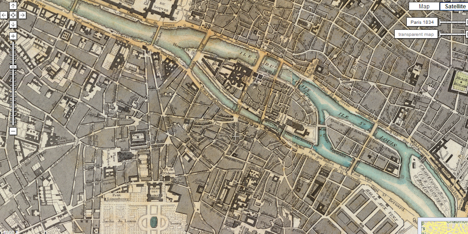
The David Rumsey Historical Map Collection contains 38,000 historical maps, mostly from the 18th and 19th centuries, with a focus on North and South America. It’s a stunning collection modern geolocation technologies and old-fashioned scholarship.
Rumsey himself has chosen over 120 maps from around the world in his collection and laid them across Google Maps. This project, and projects like it, wind up mapping time as much as they do space. You can see how things change, and how what is is dependent on what was.
“The original historical maps are first made into digital images by scanning them with high resolution digital cameras,” according to the Collection’s blog.
“Then these digital images are transformed in a process called georeferencing, which makes them display in their correct geographical spaces in Google Maps and Earth. Georeferencing is done using a GIS program, which takes points on the old maps (cities, coastlines, rivers, streets) and connects them to the same points on a modern satellite map image or a modern street map or a modern map showing boundaries of countries and states. The GIS program then takes all these points (as many as 200 are made for very large maps) and uses them to recreate the digital image so it will fit into its modern geographical space.”
Enough jibber-jabber. Look at the maps.
H/T Kottke | Photo via David Rumsey Map Collection
