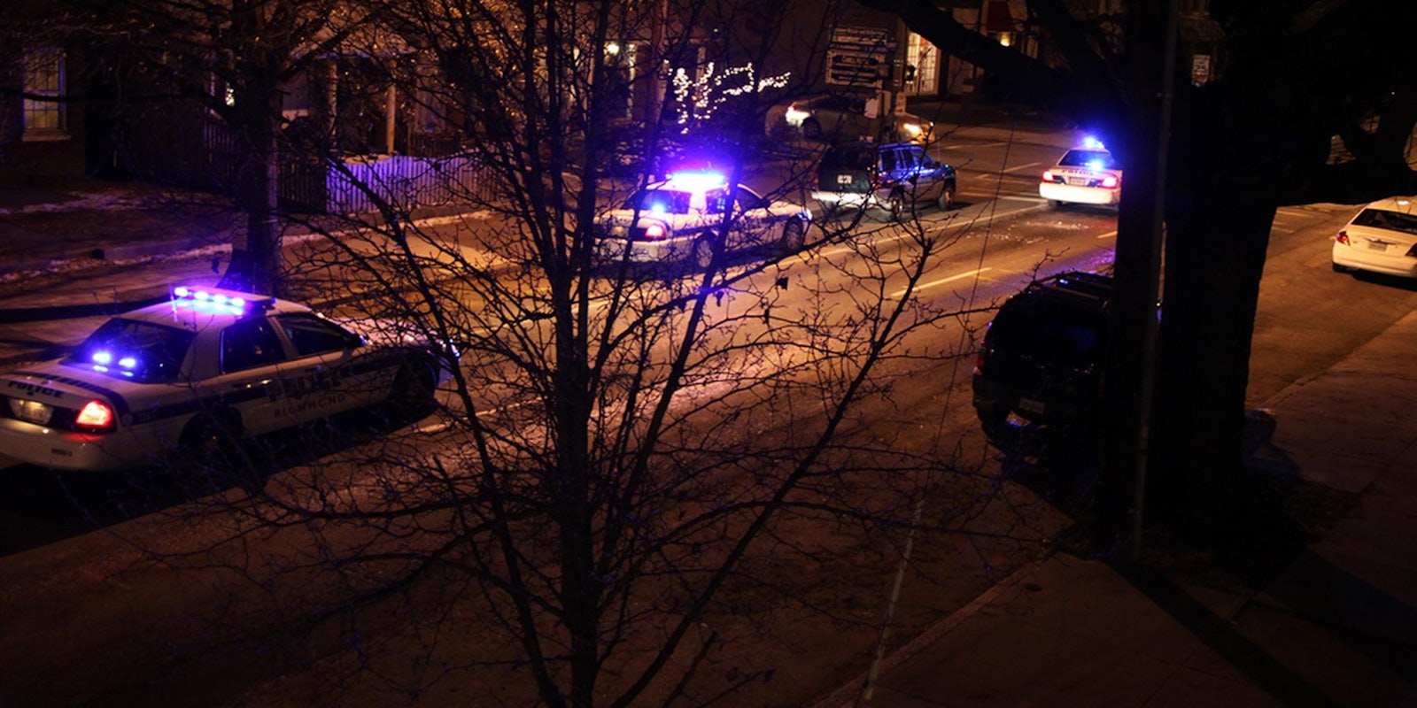
The Waze mapping app is built by users’ shared updates, making it a reliable tool for spotting traffic congestion, ongoing road work, and other outside forces that might affect your drive. One such force is the police—Waze lets users ahead of the traffic queue alert coming motorists of cops by placing pins on their locations, a feature that the law enforcement community reportedly deems life-threatening.
According to the Associated Press, a slew of police officers around the country believe the cop notifications provided by Waze—a company acquired by Google in 2013 for $966 million—can be used for stalking purposes.
In a letter addressed to Google’s chief executive last month, Los Angeles Police Chief Charlie Beck appealed to get the feature disabled, citing that criminals may not only use the community-driven app to evade capture and arrest, but actually enable those who wish to do police officers harm to locate their unwitting victims.
Sheriff Mike Brown of Bedford County, Va., addressed his concerns for the dangers of Waze’s police-tracking feature at a National Sheriffs’ Association meeting held last Jan. 23 in Washington, where he called his fellow officers to action for an effort to get Google to “act like the responsible corporate citizen they have always been and remove this feature from the application even before any litigation or statutory action.”
According to the AP, Google declined to comment on these matters and focused instead on the company’s regard for safety and security. Waze spokesperson, Julie Mossler, stated that the company is in partnership with the New York Police Department and other factions all over the world. “These relationships keep citizens safe, promote faster emergency response and help alleviate traffic congestion,” Mossler said.
In an ideal world, being able to pinpoint police officers on the road should have its merits, like having quicker access to law enforcement when emergency assistance is required, as well as encouraging drivers to slow down, drive safely, and actually follow traffic rules and regulations. Services that provide similar features could also be used to hold members of law enforcement more accountable for their actions and avoid facilitating entrapment and abuse of power. This is how Waze describes the app:
After typing in their destination address, users just drive with the app open on their phone to passively contribute traffic and other road data, but they can also take a more active role by sharing road reports on accidents, police traps, or any other hazards along the way, helping to give other users in the area a ‘heads-up’ about what’s to come.
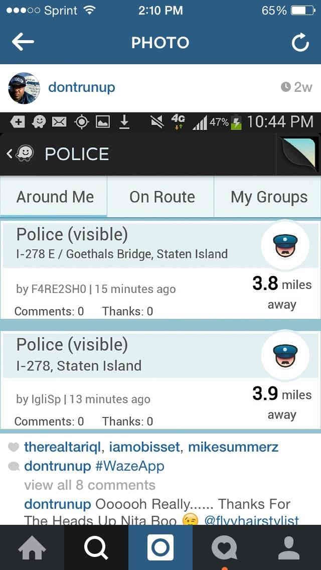
However, ensuring that well-meaning features are solely used for good is a near-impossible ordeal, especially for services like Waze that are heavily dependent on user participation. In the case of the brutal execution of two NYPD cops last month, shooter Ismaaiyl Brinsley reportedly used Waze to monitor police movement, evidenced by this screenshot from Brinsley’s now-defunct Instagram account.
While investigators do not believe that Brinsley used Waze to actually ambush the NYPD victims—Brinsely reportedly tossed his cellphone more than two miles from the crime scene—the use of the app is hardly negligible.
Waze currently still has the police-tracking feature enabled.
Update 1:36pm CT, Jan. 27: Waze spokesperson Julie Mossler issued a statement downplaying the officers’ concerns, saying that the app could not track officers or display their precise location. “Police partners support Waze and its features, including reports of police presence, because most users tend to drive more carefully when they believe law enforcement is nearby,” Mossler said.
H/T Associated Press | Photo via Gamma Man/Flickr (CC BY 2.0)
