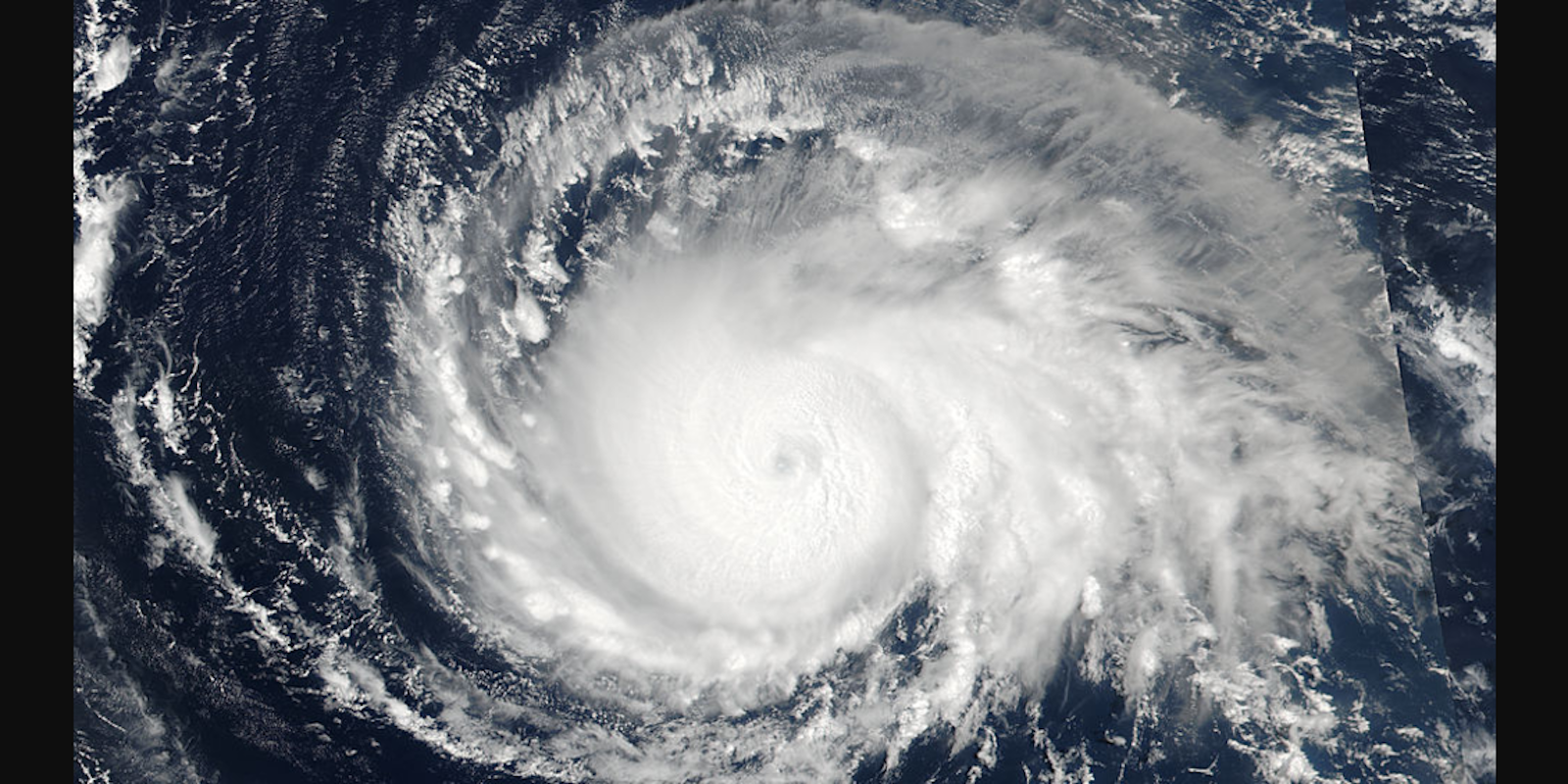
Hurricane Irma is now a category 5 hurricane as it rips through the western Atlantic, threatening to cause serious damage to the East or Gulf Coast just days after Hurricane Harvey devastated southeast Texas.
Already one of the most powerful Atlantic hurricanes in history, Irma will bring “life-threatening wind, storm surge, and rainfall,” according to the National Weather Service (NWS).
Here’s what you need to know about Hurricane Irma.
How to track Hurricane Irma
Forecasts show Irma passing over Puerto Rico midday Wednesday and hitting Florida on Sunday. From there, its path is uncertain. The National Weather Service says “it is too early to determine what direct impact Irma will have on the continental United States,” but warned, “Everyone in hurricane-prone areas should ensure that they have their hurricane plan in place.”
Here are three reliable sites you can use to track Hurricane Irma.
1) National Weather Service via NOAA
The National Weather Service is a government agency tasked with providing weather updates and releasing warnings during dangerous conditions. They are a widely cited source of information, and their forecasts are detailed and varied.
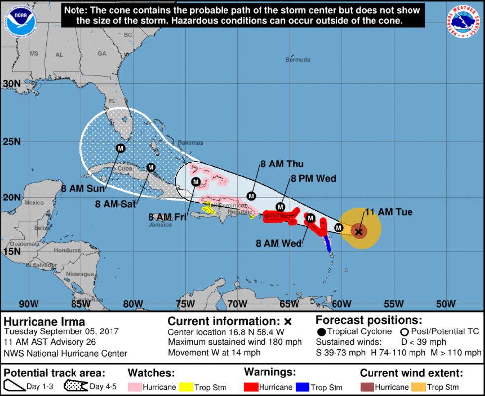
Here’s one of the several graphics the agency released to help you track Irma. Others include wind history, wind speed probabilities, and warnings and surface winds. Note: Some of these graphics don’t look dynamic, but they’ll update when you refresh your page.
2) Weather Underground
A commercial weather service out of San Francisco, Weather Underground also provides several dynamic graphics to help you track Hurricane Irma.
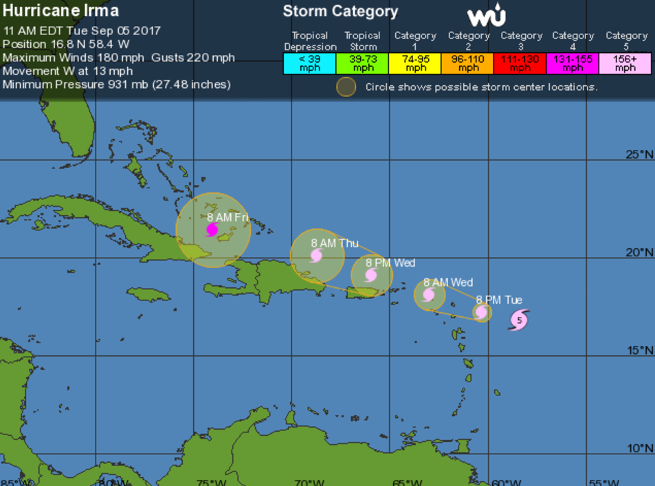
These are a bit easier to follow than those from the NWS and include satellite imagery, a five-day forecast, and computer model predictions.
3) New York Times
The New York Times uses data provided by the National Weather Service, but simplifies it with Google Maps and adds written context.
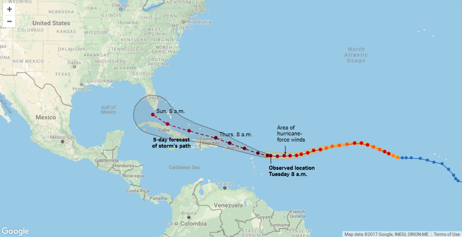
The clean graphics and images show the latest observed location of the hurricane and where it’s expected to travel.
Hurricane Irma forecast: What damage is expected?
Catastrophic damage occurs when category 5 hurricanes hit land. “A high percentage of framed homes will be destroyed, with total roof failure and wall collapse. Fallen trees and power poles will isolate residential areas. Most of the area will be uninhabitable for weeks or months,” according to the National Weather Service’s Saffir-Simpson Hurricane Wind Scale.
#Irma is the strongest #hurricane in the Atlantic basin outside of the Caribbean Sea & Gulf of Mexico in NHC records https://t.co/tW4KeGdBFb pic.twitter.com/P8ebbQJR4k
— National Hurricane Center (@NHC_Atlantic) September 5, 2017
Islands in the Caribbean could face crippling winds and destructive flooding mid-week, while Irma presents the most danger to Florida and the continental United States from Friday to early next week.
Irma is bringing maximum sustained winds of 180 mph, making it the most powerful hurricane in the Atlantic in a decade and the strongest hurricane ever in the Atlantic Ocean outside the Caribbean or Gulf of Mexico. For comparison, Hurricane Katrina’s winds maxed out at 175 mph while category 4 Hurricane Harvey reached 130 miles per hour.
Hurricane Irma: Warnings, updates, and evacuations
A hurricane warning was announced in Puerto Rico, British and U.S. Virgin Islands, and many other island nations. A hurricane watch is in effect for Hispaniola and the southeastern Bahamas.
Watch as Hurricane #Irma moves toward the Leeward Islands in this #GOES16 geocolor loop. Get the latest on Irma @ https://t.co/cSGOfrM0lG pic.twitter.com/ixIhkXqVNa
— NOAA Satellites (@NOAASatellites) September 5, 2017
Gov. Rick Scott of Florida declared a state of emergency on Monday. He activated the Florida Air and Army National Guard Tuesday morning with all 7,000 members told to report on Friday morning.
Just spoke to @POTUS – he offered the full resources of the federal government as Floridians prepare for Hurricane Irma.
— Rick Scott (@SenRickScott) September 5, 2017
“Our state emergency management officials are working with our federal and local partners to prepare for any potential impacts from this dangerous storm,” Scott said. “And it is crucial that we have access to every available resource to protect our families and communities.”
Monroe County in Southern Florida, which includes the Florida Keys, says it will issue a mandatory evacuation for visitors ahead of Irma followed by an evacuation of all residents, according to CNN.
Editor’s note: This article is regularly updated for relevance.
