Hurricane Florence made landfall as a Category 1 storm on the southern East Coast early Friday morning, bringing with it unrelenting 90 mph winds, a massive storm surge, and heavy rains that will continue to soak the Carolinas for days to come.
Speaking with NPR’s Morning Edition, North Carolina Governor Roy Cooper described the storm as “an uninvited brute who doesn’t want to leave.” “We know we’re in for a long haul here,” he said of the forecast for the coming days. “But I think we’re ready.”
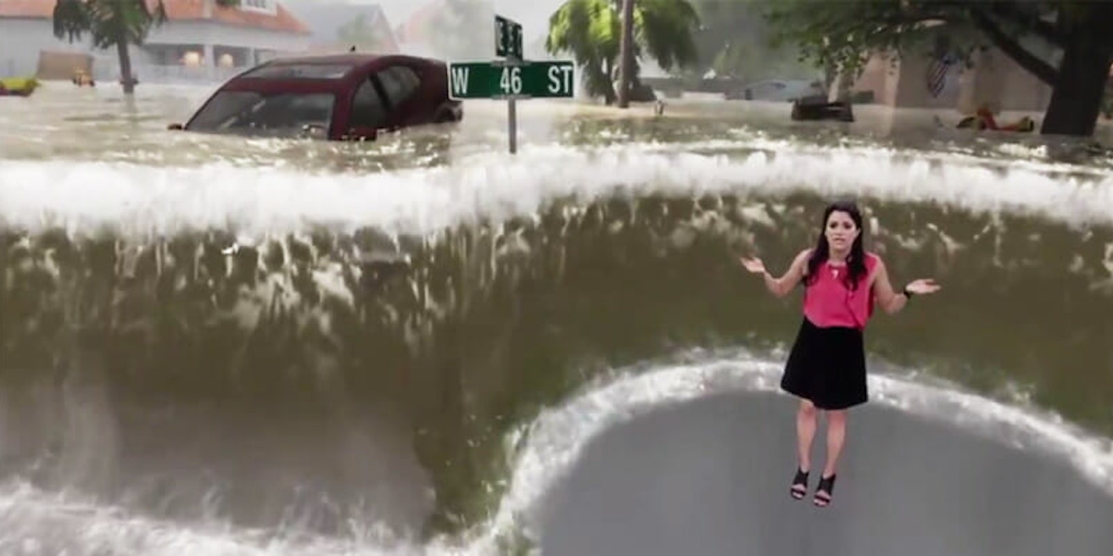
Many residents along the coast were issued mandatory evacuations, with forecasters warning of “life-threatening, catastrophic flash flooding.” To fully drive this point home, before the storm arrived on Thursday, Weather Channel meteorologist Erika L. Navarro delivered the following report using green-screen technology to illustrate just what upwards of nine feet of water could actually look like.
Storm surge will be a huge factor for Hurricane #Florence Check out what it might look like with @TWCErikaNavarro: pic.twitter.com/TPqTZTmiAM
— The Weather Channel (@weatherchannel) September 13, 2018
You have to give them credit for effectiveness because it was—in a word—terrifying. Like, it makes that John Cusack movie look like amateur hour. The point was not lost on Twitter, as the tweet containing the video went viral.
Scary as fuck weather report. First it's like, ah smart use of green screen, then it's like holy fucking shit. pic.twitter.com/J9SmZqTqVI
— Nooruddean (@BeardedGenius) September 13, 2018
Maybe the best news segment I have ever seen. Actually useful to the people on the ground. Incredible use of technology that may actually save lives. https://t.co/GuP33S7tfb
— Balaji (@balajis) September 14, 2018
https://twitter.com/antoniogm/status/1040610429716750336
https://twitter.com/dburka/status/1040364597356716033
https://twitter.com/ronanstweets/status/1040501918127271936
Utterly terrifying situation but amazing weather graphics! #florence https://t.co/6P96Zn86KL
— Debbie O'Donnell (@debbie_odonnell) September 14, 2018
Eat your heart out, CNN! pic.twitter.com/IN8MoN1NCf
— Dorsey Shaw (@dorseyshaw) September 13, 2018
With any luck, Navarro and company convinced at least a few people to evacuate who weren’t planning to do so. As of Friday morning, there were upwards of 20,000 people in 157 shelters across the state of North Carolina, and that number will only continue to climb as rescue efforts are currently underway.