


A new interactive map shows what kind of surveillance technology police departments across the country have.
The map, dubbed “Atlas of Surveillance,” was released by the Electronic Frontier Foundation (EFF) and the Reynolds School of Journalism at the University of Nevada, Reno, on Monday.
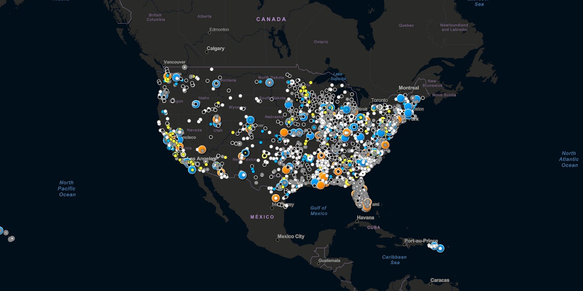
The map is a database that allows people to search on a granular level about surveillance technology used by police departments in the United States.
The map shows departments that use body cameras, drones, automated license plate readers, facial recognition, cell-site simulators, gunshot detection, predictive policing, video analytics, and ones that have a partnership with Ring, Amazon’s smart-doorbell.
The map shows around 5,000 data points for about 3,000 police jurisdictions. Users can filter what kind of surveillance is shown on the map and find out more information about specific police departments and surveillance tools they have access to.
It also allows for people to submit information that is not yet on the map.
Police use of surveillance technology has long been criticized, but has received more scrutiny recently amid protests against police brutality and racism after the police killing of George Floyd.
“There are two questions we get all the time: What surveillance is in my hometown, and how are technologies like drones and automated license plate readers spreading across the country?” Dave Maass, a senior investigative researcher in EFF’s Threat Lab and a visiting professor at the Reynolds School of Journalism, said in a statement, adding: “What we found is a sprawling spy state that reaches from face recognition in the Hawaiian Islands to predictive policing in Maine, from body-worn cameras in remote Alaska to real-time crime centers along Florida’s Gold Coast.”
You can access the map here.
READ MORE: