David Ryan Robinson doesn’t want to be known just as the map guy. Which is kind of difficult when you spend six months of your life drawing a huge A2 (that’s 23-and-a-half by 16-and-a-half inches) map of London.
It was fall 2011, and Robinson had just arrived in London. Like many young professionals, Robinson realised that the UK capital was the place to establish a firm career path. Robinson had always been into drawing, and he never got out of it. He graduated from university in June, taking a degree in art, and he knew that to advance in the creative industries he ought to move to London. “I’d only been a couple of times before,” he points out, on day trips and vacations.
He travelled down from the northwest city of Manchester (where he lived after moving from his birthplace of Rhyl, North Wales) with two months’ rent in his bank account and set up home in the capital. One of his first phone calls was to the creative manager of Cartoon Network in London. “I knew him through my tutor at university,” explains Robinson. “I just phoned and said I’d work there for free; I’ll do anything to work at Cartoon Network.” The manager said he had a job—but it would be sitting in the office, renaming files on the computer system. “At the time, I didn’t care. I thought I’d do anything.”
Originally the job was three weeks of casual labor. By the end of a month, the manager came in and asked if Robinson could stay another month to help out. Another month passed, and the same question was asked.
When Robinson walked into the Cartoon Network offices off London’s busy Oxford Street in December, he noticed a free seat in front of a Mac in the creative department. “I sat down there and started doing some design work. And then they gave me more and more things to do, and around December they said ‘Do you want a contract?’”
Robinson did. He had been coupling his work at Cartoon Network with shifts bagging groceries at Waitrose, a supermarket. “I hated it,” Robinson says of his time helping famously stony-faced Londoners choose their lettuces. When he told them he’d be leaving, his manager said he would have to work out two weeks’ notice. “I just said I’m not going to be here tomorrow, and gave them all my uniform there and then.”
It was liberating for Robinson, and working just the one job instead of two (plus freelance illustration work for magazines and newspapers such as The Guardian, the Times Higher Education Supplement, and Risk Magazine) gave him more time to devote to a project he had begun a month or so previously.
“I started doing the map around November last year,” Robinson explains, but before that he had started a project on a smaller scale. When he first moved to London, he drew a fantasy zoo, populated with animals, and decided to take on a bigger task when the 20 zoo prints he ordered sold out.
“I did the zoo, and thought ‘What else can I do that matches that scale?’”, he says. The idea of drawing a scale map of London came to him. “I just thought, why not?”
The initial enthusiasm carried him through the first sketches, drawn on paper on top of a lightbox and taped together on mountboard to form a bigger section of the map. There were times Robinson questioned the scale of the project he’d elected to undertake.
“It was massive,” he says, eyes widening.
“But once I started and began seeing pieces coming together, it was exciting. It was a massive project, so at first I was reluctant, but once I started seeing it coming together I knew it was a right decision. I thought it should look quite cool.”
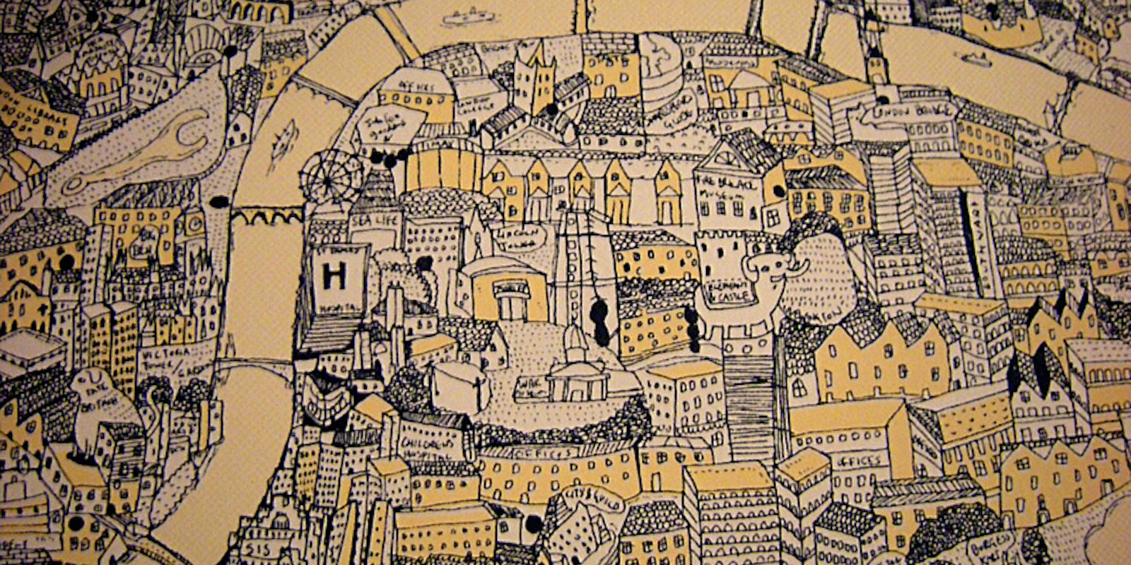
It did. It took six months in all (after a two month burst of working fairly constantly on it, Robinson took a month’s holiday from the map -– “spending nine hours solidly drawing buildings is hard … drawing buildings can be a bit boring”), but when it was complete it was a luscious, quirky representation of the British capital that managed to encapsulate the offbeat British spirit. Some of the map was drawn from personal experience as Robinson came across interesting new areas of the huge city, which spreads across 1,500 square kilometers of the southeast of England. Most of it was drawn using a tool that famous cartographers like Gerardus Mercator didn’t have back in the 16th century: Google Maps.
“It’s a lot of Google Maps,” Robinson admits, “and Street View too. If there’s a nice building I’ll Google it, but I’m lucky. I live centrally and work just off Oxford Street, so it’s quite easy to get around and look at things in person.”
Though he likes to imagine a Japanese tourist unfurling his map in the middle of Oxford Street — London’s main shopping area — on a busy Saturday afternoon, he doesn’t think many people use it as an accurate cartographical representation of the city. Though it could be, as long as you don’t take the decoration literally.
“Shepherd’s Bush has a big shepherd looking after it,” he points out. “And there are more weird monsters than people on the map. If I saw an area that looked sparse and boring, I’d just draw a monster thing there.”
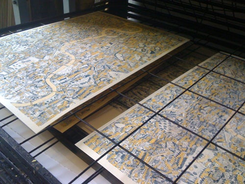
Japanese tourists did buy the map, though. “I sent a couple to Japan and quite a few to Hong Kong,” says Robinson. “It’s quite surprising how many people bought the map who aren’t from London.” TheDaily Mail came calling and told his story. The map sold out within four hours. “It got to the point where as soon as I was putting them online they were gone,” he explains, “and I’d be on the phone to the screen printers to order more.”
But Robinson isn’t just the map guy. He designs for Cartoon Network as a full-time job, and works on illustrations for magazines in his spare time. The work on his Tumblr takes next to no time –an average illustration takes 10 minutes, plus another 20 or so to scan it in and computer color it. Editorial work takes longer: a couple of hours in rough, then another three hours to do a final version for print. All have the same zany style and bright coloring to them.
Oh, and did we mention he’s doing another map?
“I approached the Zoological Society of London at London Zoo and showed them the map and the zoo I did originally,” Robinson begins. “And I asked them if they’d be interested in me doing something similar for London Zoo.
“And yeah, they were happy to go along with that. Twenty-five percent of all the sales will go to them to help support the zoo how they see fit.”
The map of London Zoo is “taking forever. At the moment it’s nearly A0, a quarter done, so it’s pretty huge.” Robinson can’t fathom the size of the work when it’s finished: “I don’t even know what they call the paper size it’ll be when it’s done,” he admits. “B something?”
Though it’s another map, Robinson is glad for the change. “There’s something about creating a zoo with animals and creating people that’s a lot more interesting than buildings,” he says. “It was nice to do the map, but I dunno …”
Once he’s finished this map, you get the impression Robinson might choose simpler, smaller, non-geographical projects. Illustrations tumble out of Robinson freely; bright, bouncing things that pop off a computer monitor. For now, he’s getting a move to a new home across the city out of the way, but after that, and after completing the map for London Zoo, Robinson isn’t sure what the next big project to monopolise his time will be. He shrugs and says: “I guess I’ll see what happens next.”
By Chris Stokel-Walker // Images via Tumblr