Among the many, many problems in securing enduring peace between the state of Israel and the nascent state of Palestine is that of establishing a workable border. A D.C.-based nonprofit is hoping crowdsourcing the line between the two countries might be the answer.
The S. Daniel Abraham Center for Middle East Peace has asked the question “Is Peace Possible?” and created an interactive map in an attempt to find an answer.
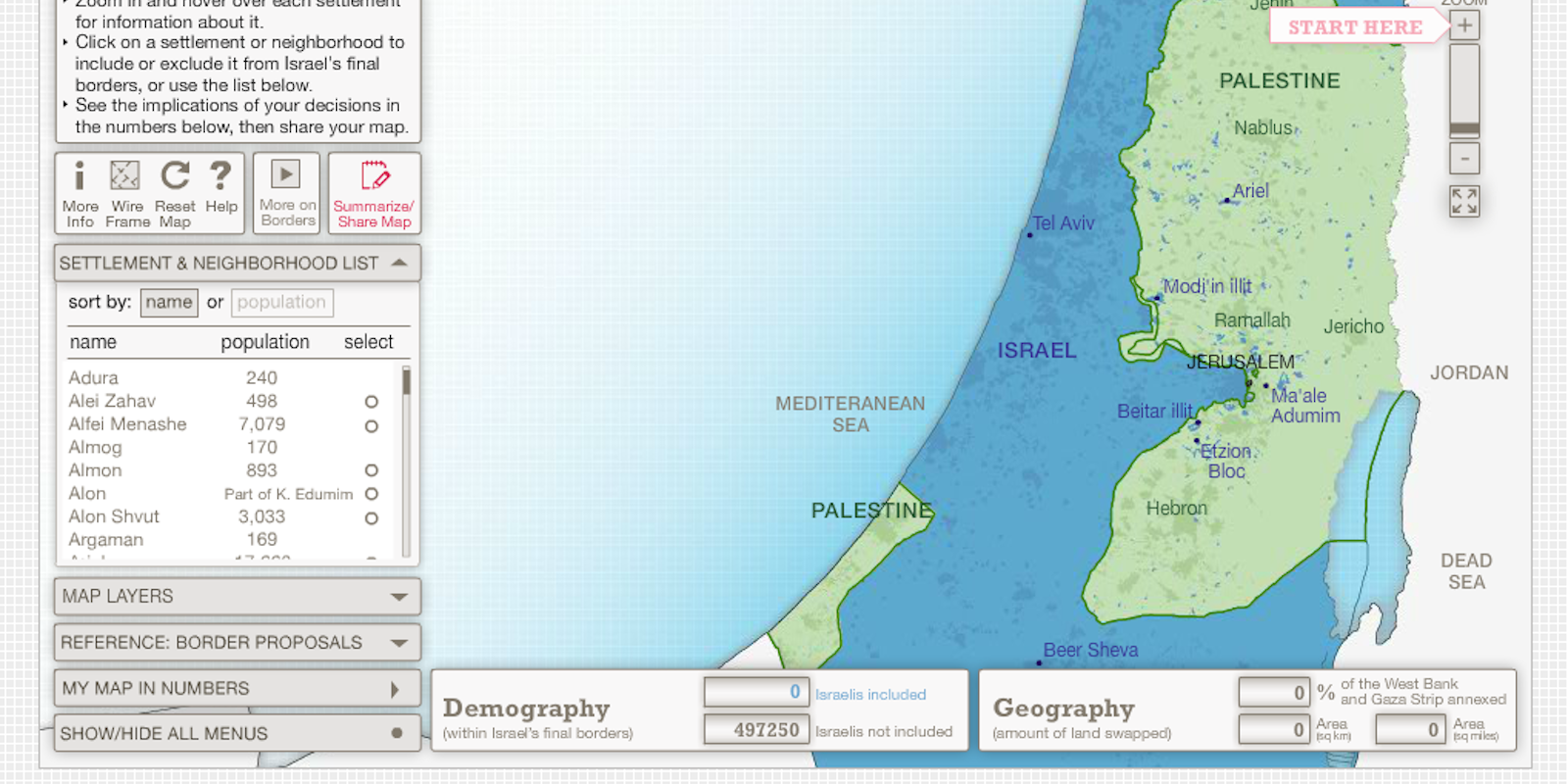
An introductory animation presents the major issues and ideas: Israel wishes to establish a border that keeps the majority of its half a million citizens currently living in the West Bank and East Jerusalem within the borders. The Palestinians wish for a state with enough contiguity to make it viable and whose size approximates the size of the combined West Bank and Gaza Strip. Land swaps are a possible avenue to the resolution of the border route impasse.
An instruction page allows users to understand the scope of the map and the tools available to draw their own suggested border. The map provides for reference the previous proposals that Israel, Palestine, and the Geneva Institute have drawn up. Detailed information is provided on settlements and neighborhoods, and map layers allow the user to distinguish between types of land and political lines.
As Lisa Goldman points out in her article in Tech President, after the United Nations voted to grant Palestine additional recognition by giving it the status of a non-member observer state, Israel responded by announcing a plan to build 3,000 new settler housing units in East Jerusalem.
“The move,” she wrote, “was widely characterized as a death blow to the two-state solution, in that it makes a contiguous Palestinian state in the West Bank geographically impossible.”
Zvika Krieger, a senior vice president for the Abraham Center and contributing editor to The Atlantic, disagreed, and set in motion this experiment.
It was immediately criticized for being created by an American non-profit and for lacking an Arabic version. Furthermore, the “wisdom of the crowds” idea has already come hard up against the tendency of online communities to collapse into the kind of incivility that can make the the border between an Israeli settlement and the Palestinian land surrounding it seem like a Victorian drawing room in comparison.
But Krieger maintains that this map experiment could work, letting ordinary people work to solve a problem that has beleaguered politicians and diplomats for generations. Borders between Israel and Palestine have seen many iterations throughout their history: the British mandate, the U.N. mandate, the original dimensions of the independent state of Israel, the border established after the Six-Day War and the Yom Kippur War, the shifting lines that have reflected the setup and occasional takedown of Israeli settlements, a provisional independence for the Palestinian state in Gaza and the West Bank, and most recently, “the wall,” the set of physical barriers set up by Israel to separate the two countries.
Who will draw the next one?
Photo via Is Peace Possible